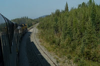
Thursday, July 23, 2009

Otters


It is hard to see the second otter, but there are 2 otters wrestling in this picture.
We saw them from the tour boat near a glacier.

Wednesday, July 22, 2009

new favorite restaurant


Piper's in Anchorage is across the street from Lake Hood.
Lake Hood is the largest seaplane base in the world, and part of Ted Stevens International.
If you Google Lake Hood on the maps part, you can see the over 100 seaplanes parked around the edge of the lake.

Mt Mckinley aka Denali

This is what we saw in Denali National Park


This is a stop farther down the road from Fairbanks to Anchorage showing what Denali looks like when there are no clouds. A woman standing close to us said that she had lived here 20 years and only seen it twice.


This is what it looked like to us coming down the road from Fairbanks, before the cloud cover boiled up. The peak is over 20,000 feet up, or 4 miles, or about twice as high as I have ever had my airplane.

Tuesday, July 21, 2009

Arctic Circle Trip


8 hours after we left, the car above turned into the car below.


This is what the road looked like, at least on the smooth parts.

The pipeline was no always visible, but it was not far away.
The GPS with lat and lon
A roadside attraction of the pipeline.
A physical representation of the size of the pipeline, and the state with the pipeline in silver.
An idea of how big it is
An unknown girl sitting atop a cutaway of the pipeline with a cleaning pig in it.
They send this device through and retrieve at the next station to clean the walls of the pipe.

My camera had a hair on it, but this is the bridge over the Yukon River, and the pipeline.
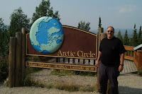
Me at the Sign proving I was there. I had to wait in line for my turn, there were half a dozen cars there, but at least it was not the tour buses that we have run into everywhere.
All through Alaska we have seen these purple flowers, sometimes in vast fields where the woods have been burnt out. Have not yet identified them.
Monday, July 20, 2009

Denali day


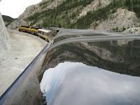
We got up early to meet the train here in Fairbanks and rode it down to Denali National Park.

The weather in Fairbanks was supposed to be sunny and 78. When we got to Denali around 12, it had turned cloudy and windy. But we enjoyed out time there anyway.

Sunday, July 19, 2009

finally fairbanks

We saw mountains in the distance
Blue lakes with a color made by glacial mud.
More mountains

A welcome sign
At the end of a long road.

Tomorrow a train trip to Mount Mckinley and Denali.

Saturday, July 18, 2009

Fridays map

Click here to go to the Google Map

Fort Nelson to WhiteHorse

This was the longest day of the trip so far.We saw this guy walking along the road and a bunch of others just hanging out.
The mountain goats were standing by the side of the road.

I think these are Elk, or Caribou. The ones we saw were losing their winter coat for summer, so they looked a bit rough.
At one point we had to follow some traffic through newly laid down gravel.

A couple times we lost the car ahead in the dust.

This lake turned out to be a photo dream.

signposts in Lake Watson
click for more info

We went out of our way to see this one, the DC3 is a wind direction indicator.

Thursday, July 16, 2009

Fort Nelson


We took a shorter initial drive today, and got to Fort Nelson about noon.
A quick subway, and check in and then we set off straight north so we could visit the Northwest Territories.
The second drive proved that up here when you start down a big hill there will be a river at the bottom.
We went over two rivers on the way to the border. We also got to sit for 20 minutes with the car off, while we waited for the repair trucks to work on the road. Anyway, we got it done, and tomorrow we will be on the road for 11 hours up to White Horse, Yukon territory. Look at a Canada map, we have covered most of the territories, or provinces at this point. I told Bill one of my next trips would be to Maine, so I could say that I Have been on all 4 corners of the United States.

Waking up in Fort Saint John BC

It was a quiet night here. The ac worked until the evening cooled off. The morning brought a blue sky marbled with clouds.
Fort Saint John is the largest town in the area and is mostly a place to stop on the Alaska Highway or home for oil and lumber workers.
We crossed the Peace river yesterday, which came as a little surprise.
The road had been winding a bit through farms and oilfields and pine woods, when we saw a grade sign, and the road started dropping. Bill took us through a 10 per cent grade and we figure about a thousand feet of elevation change down to the river. We crossed a metal suspension bridge and then climbed out the other side, next to a coal distribution center.

From there it was more of the same gently rolling hills covered with patches of brilliant yellow, something that we have been seeing since we entered Canada, but have not yet identified.

The feller at the Gas station we stopped at in Alberta just before we hit BC spent some extra time to squeeze all the gas he could into the tank, stating that we were going to Bring Cash, and then launched into a short tirade about the taxes in that province. The gas went up about ten cents per liter, which I think tranlates to about 40 cents on the gallon in BC, so he may have had a point.

Today we head up to Fort Nelson, a fur trader outpost that has since turned into a place for people to stop on the way to Alaska. More when we get there.

Wednesday, July 15, 2009

Starting up the Alaskan Highway


We go to Fort Nelson tomorrow, and then up to the northern territories.
Then 2 eleven hour days in a row, and we will be in Fairbanks.
Posted by Picasa

Beaver from Beaverlodge


The town put up this giant beaver in honor of their name. Had to share a picture
Posted by Picasa

Moose and her Baby


We saw a Moose and her baby. She ran the baby across the road, and then stopped to give us the eye.
Posted by Picasa

Tuesday, July 14, 2009

Rainbow


I almost forgot, we saw a rainbow today that was probably the most complete I have ever seen.
It had at least 4 distinct colors, and we could see both ends.

Pics from Banff and Jasper National Parks

In no particular order, this is the Banff Hotel
Not sure where the lake is, but it had some good color
Lake Louise, proabably looks better in the sun
A mountain
My camera took a picture of me while I was not looking

Vans that take tourists on the Glacier from a few miles away
The same glacier next to me
Athabasca fall, aka basketball falls
A bear
We could tell when there was one by the side of the road, as the traffic backed up.